f9368e12-c14c-4094-978d-bc3a30541b9b.jpeg.jpg


View Original Image at Full Size

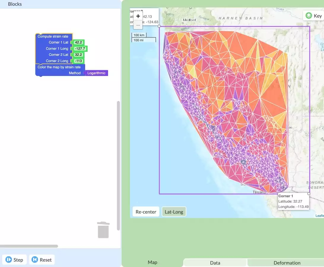
GeoCode example. Map of California strain rates as determined through student coding using GPS data.
Originally uploaded in NAGT:Our Work:Professional Development:Webinars:GeoCode Using GPS Data to Visualize Plate Movement and Assess Earthquake Risk.

Image 253075 is a 900 by 1092 pixel WebP
Uploaded: Apr7 21


Last Modified: 2021-04-07 12:13:07
Permanent URL: https://serc.carleton.edu/download/images/253075/f9368e12-c14c-4094-978d-bc3a30541b9b.jpeg.webp

The file is referred to in 1 page
Provenance
Shelley Olds (UNAVCO)
Reuse
This item is offered under a Creative Commons Attribution-NonCommercial-ShareAlike license http://creativecommons.org/licenses/by-nc-sa/3.0/ You may reuse this item for non-commercial purposes as long as you provide attribution and offer any derivative works under a similar license.