Artwork2.PNG


View Original Image at Full Size

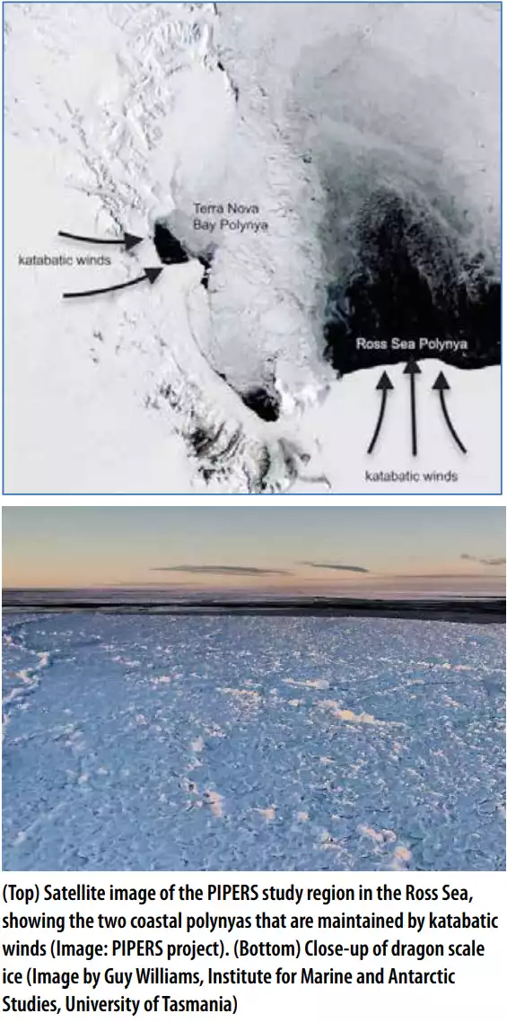
(Top) Satellite image of the PIPERS study region in the Ross Sea, showing the two coastal polynyas that are maintained by katabatic winds. (Bottom) Close-up of dragon scale ice
Originally uploaded in NAGT:Our Resources:In the Trenches:2020 - Volume 10:In the Trenches - October 2020.

Image 249998 is a 1139 by 565 pixel WebP
Uploaded: Oct19 20


Last Modified: 2020-10-19 18:04:22
Permanent URL: https://serc.carleton.edu/download/images/249998/artwork2.webp

The file is referred to in 1 page
Provenance
(Top) (Image: PIPERS project) (Bottom) (Image by Guy Williams, Institute for Marine and Antarctic Studies, University of Tasmania)
Reuse
This item is offered under a Creative Commons Attribution-NonCommercial-ShareAlike license http://creativecommons.org/licenses/by-nc-sa/3.0/ You may reuse this item for non-commercial purposes as long as you provide attribution and offer any derivative works under a similar license.